
This is an old revision of the document!
Import from surface
This tutorial shows how to make a layer boundary from a surface. XYZ Points are samplet from an existing 2D surface and imported into interpretations point database table
Requirements:
- Interpretation points
- 2D Surface
Step 1. Import surface points
1. See Setting up Data for Modelling.
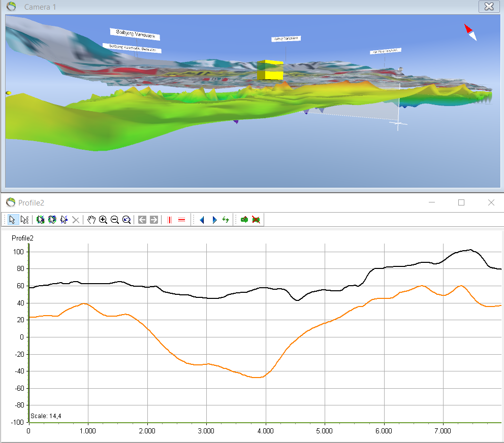
- After the layer model has been built the terrain layer and the kriging surface can be visualized in the 3D window and the profile. The kriging surface will be used to create the layer boundary for L1.
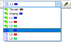
- In the GeoScene3D project there is a bar for editing the different surfaces and points.
2. Click the point layer you want to create by using a surface.
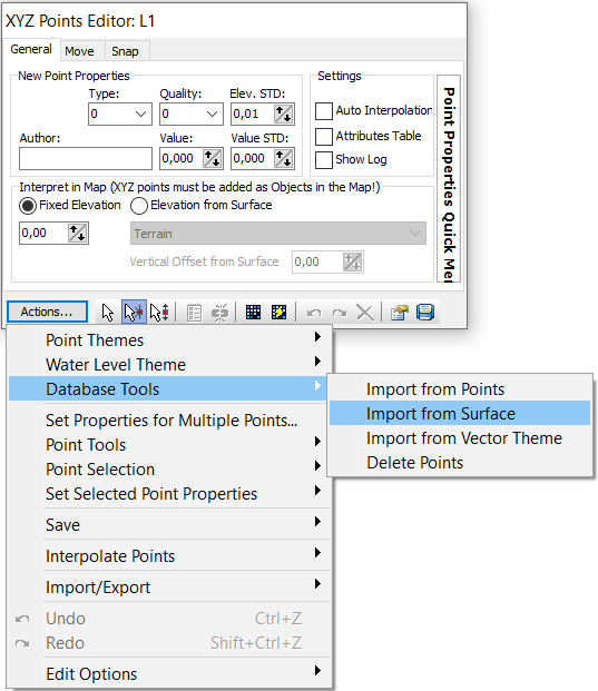
3. “Actions…” –> “Database Tools” –> “Import from Surface”.
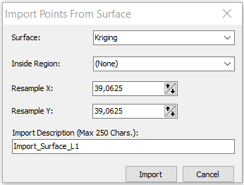
4. “Surface: Kriging”. Also give a name for the “Import Description” –> Import.
Step 2. Results
1. In the “XYZ Points Editor” a small icon can be clicked  when points are ready for interpolation or if the grid needs to be updated after the edit of points –> “stop edit session”
  .
.
- The resultant profile after the import of the kriging surface
