
This is an old revision of the document!
Import from surface
This tutorial shows how to make a layer boundary from a surface
Requirements:
- A layered model
1. See Setting up Data for Modelling.
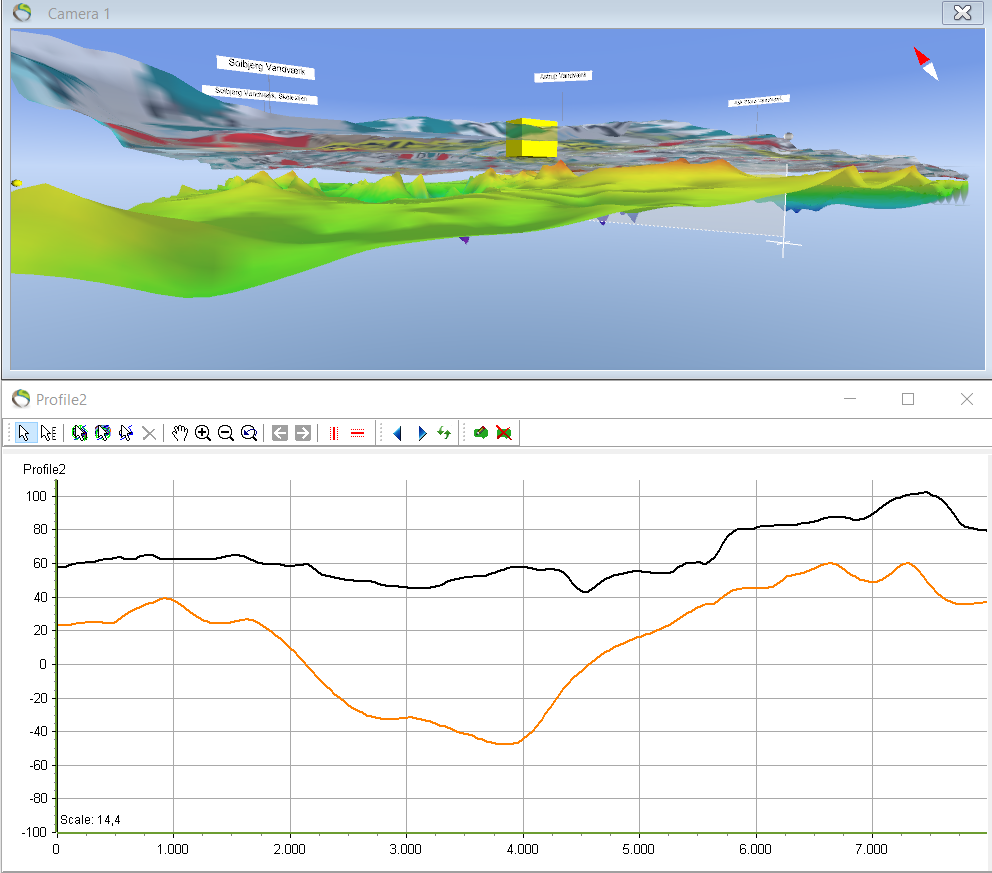
After the layer model has been built the terrain layer and the XYZ points can be visualized in the 3D window and the profile. This XYZ points will be used to create the layer boundary for L1.
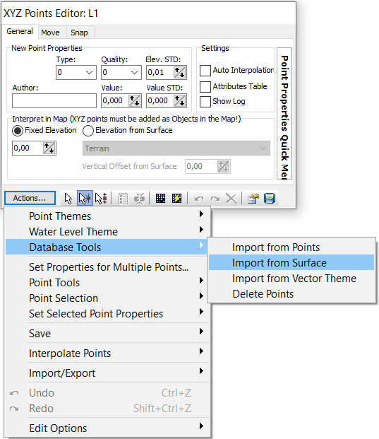
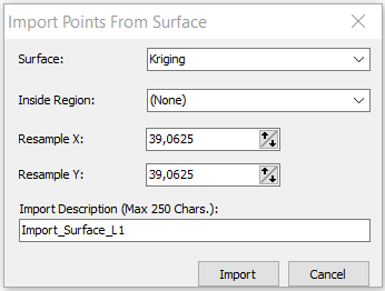
“Points Database: XYZ Points” –> import. Also give a name for the “Import Description” –> Import.
- The resultant profile after the import of the kriging surface
