
Import from surface
This tutorial shows how to make a layer boundary from a surface. XYZ Points are samplet from an existing 2D surface and imported into interpretations point database table
Requirements:
- Interpretation points
- 2D Surface
Step 1. Import surface points
1. See Setting up Data for Modelling.
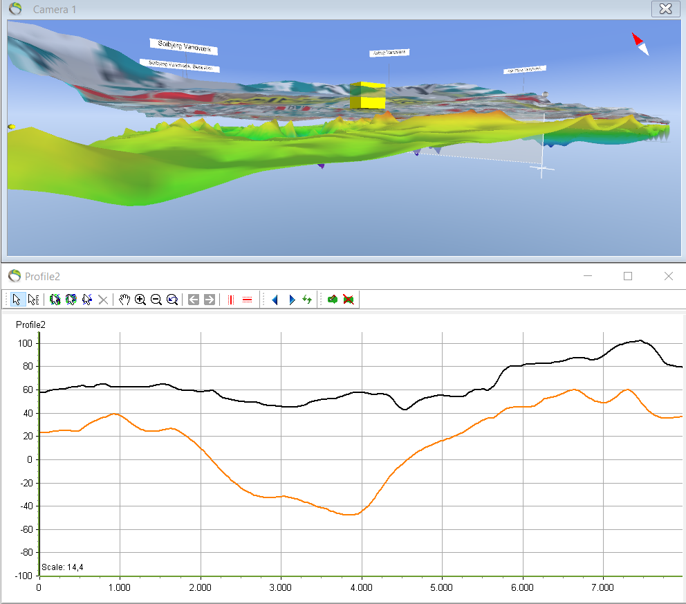
- The terrain and the kriging surface can be visualized in the 3D window and the profile. The kriging surface will be used to create the layer boundary for L1.
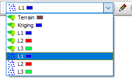
- In the GeoScene3D project there is a bar for editing the different surfaces and points.
2. Click the point layer you want to create by using a surface.
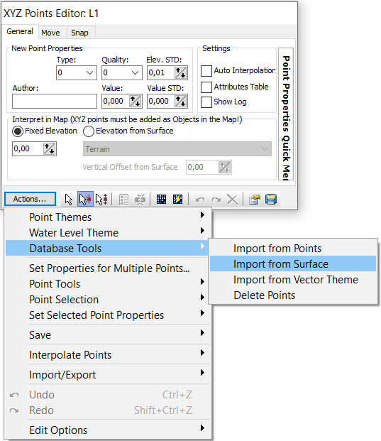
3. “Actions…” –> “Database Tools” –> “Import from Surface”.
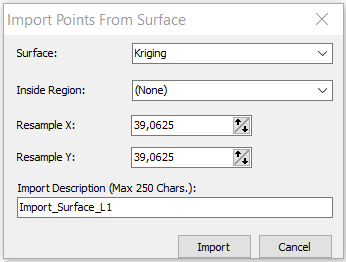
4. “Surface: Kriging”. Also give a name for the “Import Description” –> Import.
5. In the “XYZ Points Editor” a small icon can be clicked  when points are ready for interpolation or if the grid needs to be updated after the edit of points –> “stop edit session”
  .
.
- The resultant profile after the import of the kriging surface
