Water Level Map & Theme
The Water Level Theme is an extension to the geological modelling tool in GeoScene3D and can be used to extract water level measurements based on different conditions. It contains a number of data extractions and features e.g.
- Use existing surface models/geological model (used for potentiometric maps)
- Used without an existing geological model (used for non-potentiometric maps)
- Automatic search of water level measurements based on a number of data settings and from existing borehole database (PC-Jupiter).
- Data sorting include
- horizontal (surface based) and vertical (region based) boundaries
- time period (date, year, from-to)
- max., min. or mean within the given time period
- calculation of standard deviations (STDs) for multiple measurements during a search
- manual assignment of STDs value
- Indication of if the filter must be partially or completely located in a given layer.
- Manual sorting and addition of water level data
- Easy allocation of supporting points based on terrain model and GIS themes for streams, lakes and coastline.
Requirements
Data
You need a borehole database (standard JUPITER or a generic well database with the presence of both a screen and water level data, that are coupled by a screen index) with water level measurements and screen information. If the required result is one (or more) potentiometric map(s), you also need a geological model with 2D grids indicating the groundwater reservoir.
Step 1. The Water Level Wizard
1. Create new point databases and surface grids. See the tutorial: Setting Up Data For Modelling. It is also possible to add the data to an existing database.
2. Start the “Edit Session” for the new (or existing) point database.

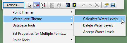
3. Go to “Actions” and choose “Water Level Theme” → “Calculate Water Levels”.
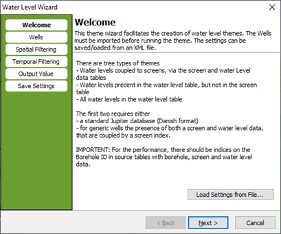
4. The welcome page. You can load settings if you have saved the settings from a previous calculation.
Step 2. Extract Water Levels from Wells with Screens
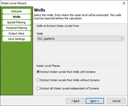
1. Choose the database, from where the water level will be extracted. Select the Water Level Theme: Extract Water Levels from Wells with Screens.
2. First choose the top and bottom surface between which the screens are extracted. If you do not want any surface constrains please choose “none”.
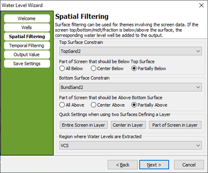
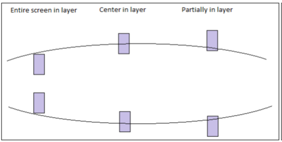
Second choose the part of the screen that should be below the top/above the bottom surface. The drawing shows the different options. Either the entire screen is between the top and bottom surface, or the center of the screen is between the top and bottom surface, or the screen only need a minor part between the top and bottom surface.
You can choose differently for the top and bottom surface.
Third choose inside which region you want the water levels extracted. If you want the extraction in the whole scene extent, please choose “none”.
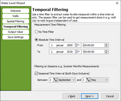
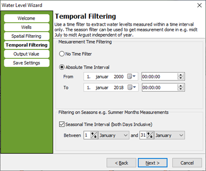
3. Temporal filtering. Select a time filter and select further if you want to filter on seasons.
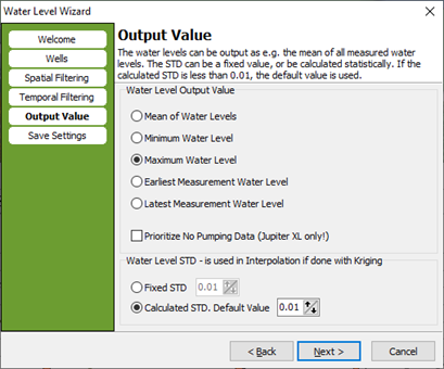
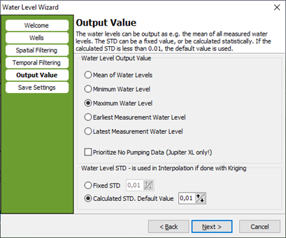
4. Choose the output value, and the water level standard deviation. The STD can be a fixed value or can be calculated statistically.
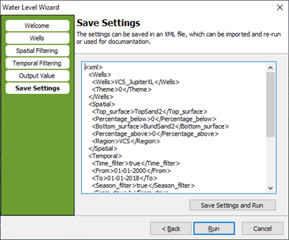
5. Press “Save settings and Run” to save the settings before running the extraction. If you do not want to save the settings, please press “Run”.
Step 2. Results
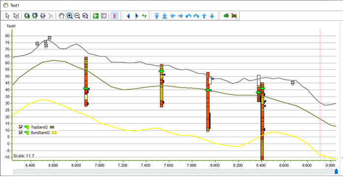
1. Water levels are extracted based on screen information and information about the top and bottom surface.
Step 3. Extract Water Levels from Wells without Screens
1. Choose the database, from where the water level will be extracted. Select the Water Level Theme: Extract Water Levels from Wells without Screens.
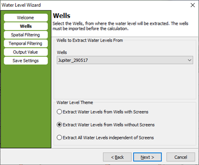
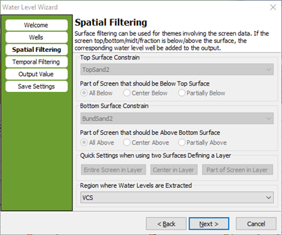
2. When extracting water level from wells without screens the spatial filtering is not available. You may choose a region where water levels are extracted.
3. Temporal filtering. Select a time filter and select further if you want to filter on seasons.
4. Choose the output value, and the water level standard deviation. The STD can be a fixed value or can be calculated statistically.
