
This is an old revision of the document!
Graticules
Step 1. Grid lines
Graticules  can be used on the map to define small areas on the map and for referral.

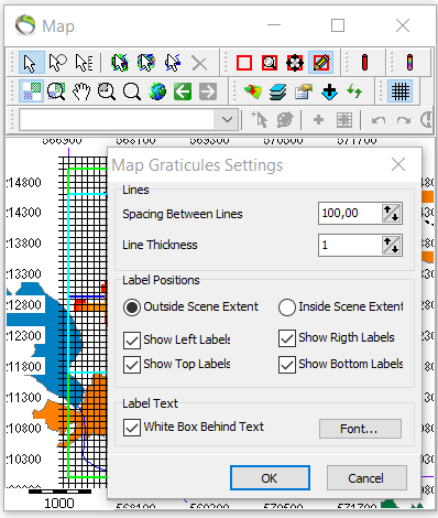
1. After graticule application rightclick on the map –> map graticule settings.
Step 2. Coordinate labels
1. Repeat step 1.1. to get to “Label Positions”.
- Here it can be decided whether coordinates are wanted inside/outside the scene extent.
- It can also be clicked where the coordinates are wanted according to left/right and top/bottom.