This is an old revision of the document!
Measure Tool
The Measure tool lets you draw to measure lines. You can use this tool both in the 2D map window and in the 3D camera window.
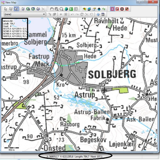
When you activate the Measure tool, the Measure information appears in the top left corner of the 2D map window with the total length and XYZ coordinates of the given point, black square in image below. In the bottom toolbar of GeoScene3D, the total Length and the Next segment of the measurement is given next to the X and Y coordinates, black circle in image below.
Example:
When the Measure Tool is activated, the lightgreen line is the measured length.

