Table of Contents
Upgrading Access Interpretation Database
Introduction
Access-based interpretation databases are no longer supported in Geocene3D and have been replaced by the SpatiaLite format. To continue working with existing data, a one-time conversion to SpatiaLite is required.
During the conversion, a new SpatiaLite .sqlite file is created, and all valid interpretation data is copied into it. Once the conversion is complete, the new database is ready for use — you can start edit sessions and add new interpretation points as needed.
Converting Access to SpatiaLite
Step-by-Step Workflow
1. Open the Source Manager
- Click the Source Manager icon in the toolbar or use the Manager menu.
2. Find the Access database
- In the source list, locate the Access source file to convert.
3. Right-click and convert
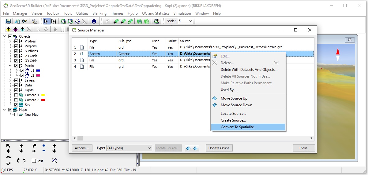
- Right-click the Access source and select Convert To SpatiaLite… from the context menu.
4. Configure conversion settings
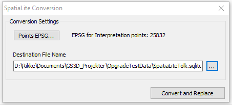
- Click Points EPSG… and choose the appropriate EPSG code
- Set the Destination File Name for the new .sqlite file
- Click Convert and Replace
5. Check result in Source Manager
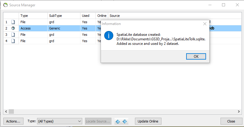
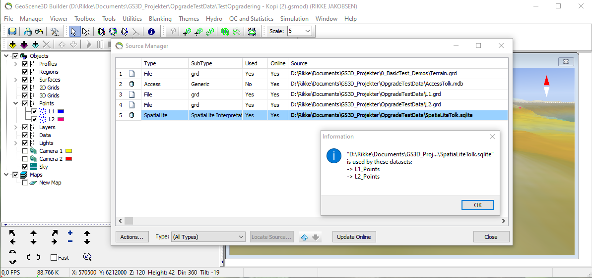
- A new SpatiaLite source is added to the list
- Any linked point layers (e.g., L1, L2) are now automatically connected to the new SpatiaLite file
- The original Access source remains but is no longer used. It can be removed manually
- Optional: Select “Used by” to see which interpretations point are now using the new Spatialite file
6. Start editing
- The project is now ready to continue with the converted database
- You can start a new edit session to add points to the new database
Additional Information
Tables Converted
- Only tables with UID, X, Y, and Z columns are included in the conversion
- These columns are required for a table to be recognized as an interpretation table
- For each valid table, all standard fields are preserved in the SpatiaLite output (SpatiaLite Interpretation Database)
- Tables are included even if they were not point layers in layer manager
- This ensures a complete and independent conversion of all valid interpretation tables
Coordinate Handling
- During conversion, the X and Y columns from Access are merged into a single geometry field named XYPoint (see also SpatiaLite Interpretation Database)
- This field is stored as a 2D POINT with the selected EPSG code, used for correct placement in external GIS tools (e.g., QGIS)
- The Z value is kept as a separate column representing elevation
- Geocene3D itself does not use projections, so the EPSG code is only relevant when working with external applications
Stand-Alone Conversion
- Access sources can be converted immediately after being added to the Source Manager, even if no tables are imported as interpretation points
- This enables a fast, stand-alone upgrade to SpatiaLite without any modelling setup
- After conversion, the new .sqlite file can be used in Setup Data for Modeling to add interpretation points. Select “Use existing database” and select tables


